


go
You may also like
06 nov
2014
Aerial View of the Rideau Canal
2014
|
|

|

|

|

Title:
Untitled.
Reference number:
No reference number provided.
|
We gave it a
-5
Numerous heritage buildings demolished when the Gréber plan was implemented.
|
Visitors's vote
+0.1
122 votes
Vote here
better
now better
before |
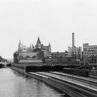
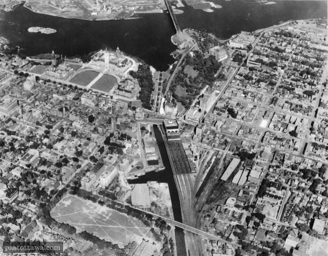
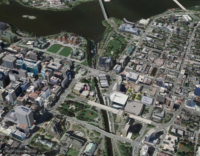
This aerial view of the downtown Ottawa shows how the land around the Rideau Canal has changed over the years. The year at which the picture was taken can be estimated to 1927 from the existing buildings and landmarks; The Russell House burned down in 1928 and the Peace Tower was inaugurated in 1927.
The most obvious missing part is the basin (lay-by) of the Rideau Canal at the end of Slater Street. The basin was extending on both sides of the Rideau Canal, but the archival photo only shows the West portion since the East portion was filled in the 1870s to make more room for railroads. The West portion of the basin was removed in 1927 for development purposes.
South of the basin, the Laurier Avenue arena, where the Senators won several Stanley Cup, can be seen. The North-end of Elgin Street was more urbanized since we could find several buildings, now long gone, like the first City Hall and the Russell House.
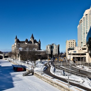
Finally, Elgin Street which used to be a more modest street has been widened (all the buildings East of it have been demolished) and transformed into an 8-lane urban boulevard which had a deep impact on the dynamic of the whole Ottawa's core.
12 NOV
2014
2014
Jonathan
Again, this image can't be 1920ish since the Peace Tower was not unveiled until 1927. This photo is from NO EARLIER than 1927 if not later....
18 MAR
2015
2015
Eric Goodwin
One of my favourites.... Is there a larger cropping of the old image or is that it? I'm interested in some buildings just off the right edge in Sandy Hill.
2 Comments