


change
Order
Display
10 fév
2015
Brewery Creek in Hull
2015

|
We gave it a
-5
Decades of decay of the urban fabric which needs to be fixed.
|
Visitors's vote
-1.8
141 votes
Vote here
better
now better
before |
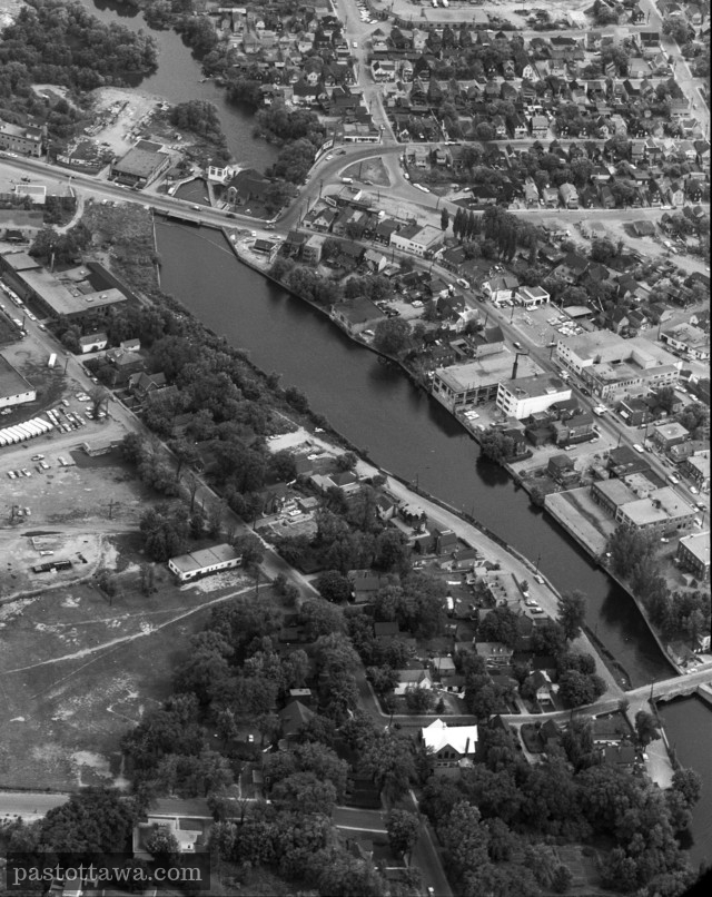
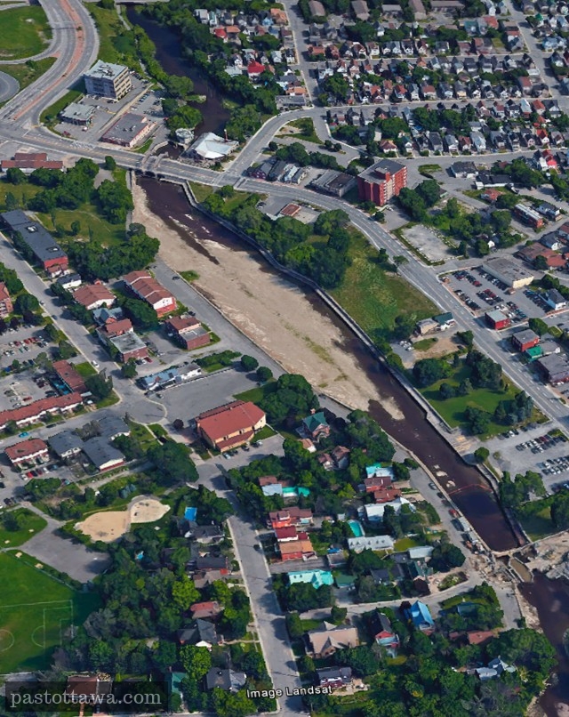
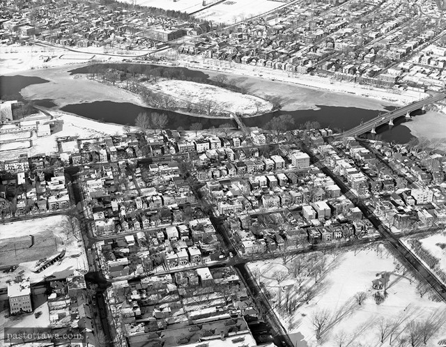
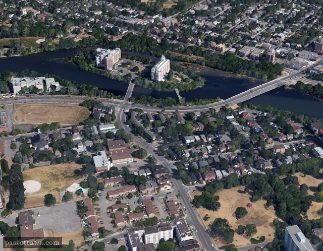
Gatineau mayor Maxime Pedneaud-Jobin seems convinced that he will succeed in bringing life into the long-time ignored and decaying area around the Brewery Creek in Hull.The area is quite different when you compared both pictures which are separated by about 60 years. Almost all the buildings on the East-side of...
Read more >>
|
|

|

|

|
Title:
Untitled.
Reference number:
CA001373
|
We gave it a
-5
Succession of re-configurations of the area in which the final "product" lack interest.
|
Visitors's vote
-2.8
133 votes
Vote here
better
now better
before |
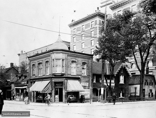
The North-East corner of the intersection of Elgin Street and Laurier Avenue in Ottawa was quite different back in 1928 compared to the busy intersection we are used to nowadays. In the shadow of the Roxborough Apartments and the Woods Buildings, humble houses hosted a "druggist" and a corner store when...
Read more >>
|
|
|
|
|
Title:
Untitled.
Reference number:
CA008171
|
We gave it a
-5
Urban renewal which turned out to be a tremendous failure.
|
Visitors's vote
-2.1
132 votes
Vote here
better
now better
before |
This aerial photo of Lowertown East demonstrates how much it has changed after the 1970 textbook urban renewal.St. Patrick Street which used to be a traditional main street with its stores and residences has been completely demolished and stripped from its built elements which consequently had it lost its main purpose. It...
Read more >>
06 nov
2014
Aerial View of the Rideau Canal
2014
|
|
|
|
|
Title:
Untitled.
Reference number:
No reference number provided.
|
We gave it a
-5
Numerous heritage buildings demolished when the Gréber plan was implemented.
|
Visitors's vote
+0.1
122 votes
Vote here
better
now better
before |
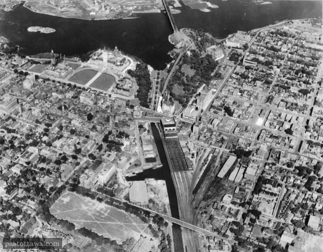
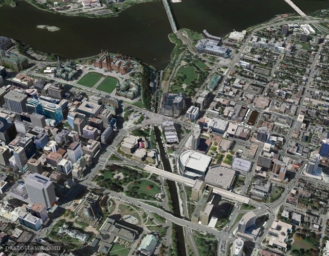
This aerial view of the downtown Ottawa shows how the land around the Rideau Canal has changed over the years. The year at which the picture was taken can be estimated to 1927 from the existing buildings and landmarks; The Russell House burned down in 1928 and the Peace Tower...
Read more >>
go
0 Comments