


City Hall
06 nov
2014
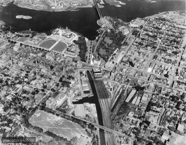
Aerial View of the Rideau Canal
2014
|
|

|

|

|

Title:
Untitled.
Reference number:
No reference number provided.
|
We gave it a
-5
Numerous heritage buildings demolished when the Gréber plan was implemented.
|
Visitors's vote
+0.1
122 votes
Vote here
better
now better
before |
This aerial view of the downtown Ottawa shows how the land around the Rideau Canal has changed over the years. The year at which the picture was taken can be estimated to 1927 from the existing buildings and landmarks; The Russell House burned down in 1928 and the Peace Tower...
Read more >>
31 aou
2014
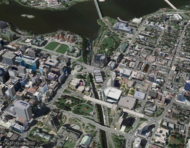
Aerial View of Elgin Street with Parliament
2014
|
|
|
|
|
Title:
Untitled.
Reference number:
No reference number provided.
|
We gave it a
-5
The dynamic in the core would have been totally different if Elgin would have not been widened.
|
Visitors's vote
-1.1
117 votes
Vote here
better
now better
before |
This aerial view reveals that the northern section of Elgin Street has drastically changed over the years. Essentially, all the buildings located on the East side of Elgin Street have been demolished to make room for the NAC and the War Memorial. We believe that the dynamic of downtown Ottawa...
Read more >>
15 fév
2014
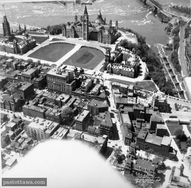
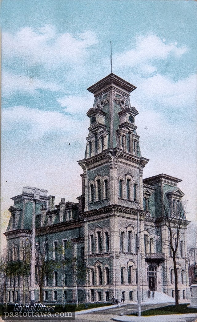
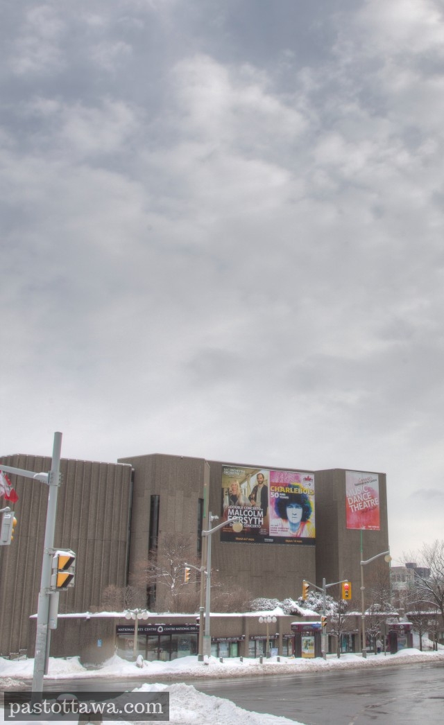
Former City Hall on Elgin Street
2014
|
|
|
|
|
Title:
Untitled.
Reference number:
No reference number provided.
|
We gave it a
-4
NAC which is turning its back to Elgin Street replaced a classic building & a public place
|
Visitors's vote
-4.2
98 votes
Vote here
better
now better
before |
The building was located on Elgin Street between Queen and Albert Streets.The second Ottawa City Hall was destroyed by a fire in 1931...
02 fév
2014
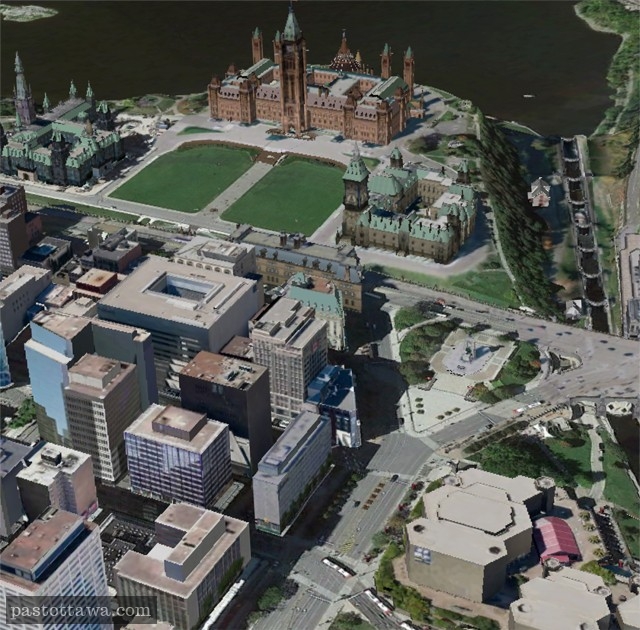
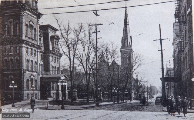
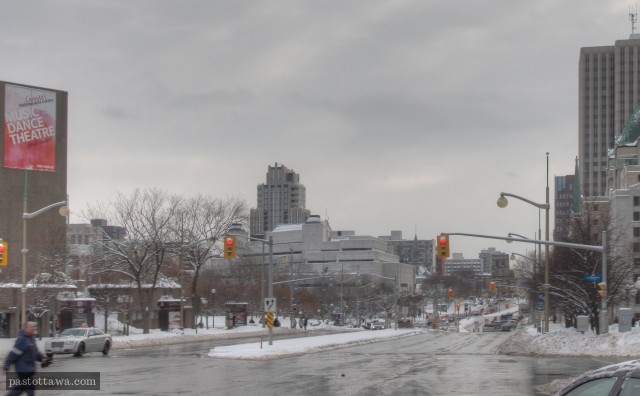
Elgin Steet & City Hall
2014
|
|
|
|
|
Title:
Untitled.
Reference number:
No reference number provided.
|
We gave it a
-5
The north end of Elgin Street is now a urban thoroughfare.
|
Visitors's vote
-4.3
86 votes
Vote here
better
now better
before |
All the buildings on the photo disapeared:City HallKnox ChurchGrand Union Hotel...
go
2 Comments