


map
20 jan
2013
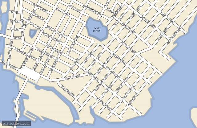
Hull in 1894
2013
|
|

|

|

|

Title:
Untitled.
Reference number:
No reference number provided.
|
We gave it a
-3
Downtown Hull was disfigured by the too imposing Maisonneuve Boulevard.
|
Visitors's vote
-1.2
90 votes
Vote here
better
now better
before |
09 jan
2013
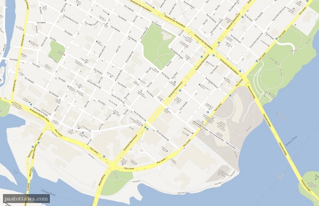
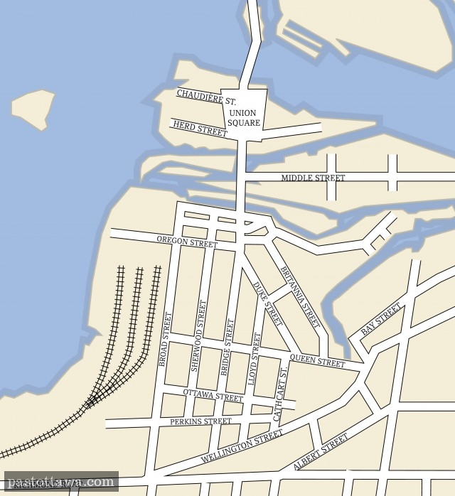
Lowertown East Map
2013
|
|
|
|
|
Title:
Untitled.
Reference number:
No reference number provided.
|
We gave it a
-5
Functional street grid replaced by dead ends and urban boulevard. Urban renewal of the 70s.
|
Visitors's vote
-3.2
44 votes
Vote here
better
now better
before |
05 jan
2013
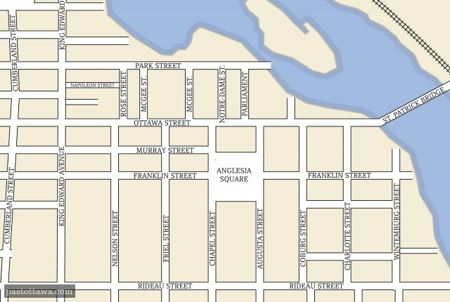
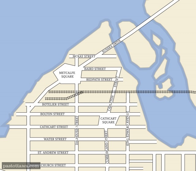
Lowertown north before DFAIT
2013
|
|
|
|
|
Title:
Untitled.
Reference number:
No reference number provided.
|
We gave it a
-5
A highway cuts through the Byward Market and has replaced the linear park on King-Edward.
|
Visitors's vote
-1.6
41 votes
Vote here
better
now better
before |
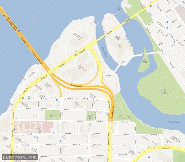
The major changes in that area are the widening of King-Edward Avenue and the construction of the Foreign Affairs Department (DFATD). Ironically, the streets Baird and Mckay were laid out exactly where the DFATD building is right now. Peter McKay is the former head of DFATD and John Baird is...
Read more >>
29 déc
2012
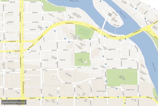
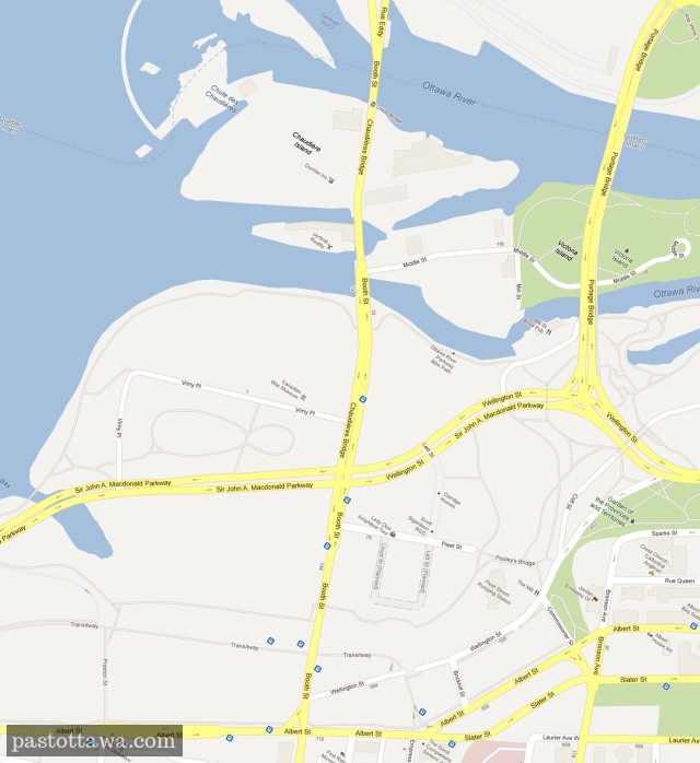
Map of LeBreton Flats
2012
|
|
|
|
|
Title:
Untitled.
Reference number:
No reference number provided.
|
We gave it a
-5
The NCC expropriated and let Lebreton Flats sits empty for 50 years.
|
Visitors's vote
-2.4
52 votes
Vote here
better
now better
before |
LeBreton Flats had it rough. First, it was devasted by the 1900 fire. Around 60 years later, it was demolished a second time after massive expropriation authorized by the NCC. The NCC sat on this empty piece of land for nearly fifty years.Finally, in 2005, the LeBreton Flats received the...
Read more >>
go
0 Comments